Propeller Acquires Spacesium to Automate Spatial Mapping for Mining Sites
- Propeller has acquired Spacesium to embed geospatial algorithms into its 3D mapping platform.
- The integration enables AI-driven analysis of haul roads and mining site compliance.
Propeller, a 3D mapping and data platform used by mining, aggregates, and civil industries, has acquired Spacesium, a company specializing in spatial data science. Propeller is known for tools that help teams map, measure, and manage worksites using aerial imagery and real-time data. The acquisition is intended to strengthen Propeller’s platform by automating complex site analysis and safety checks through integrated geospatial AI.
Spacesium develops algorithms that turn 3D spatial data into usable insights. Its tools detect and interpret physical site features automatically, enabling real-time validation of terrain against design and compliance standards. Propeller says that these algorithms have already been tested with its customers in live environments.
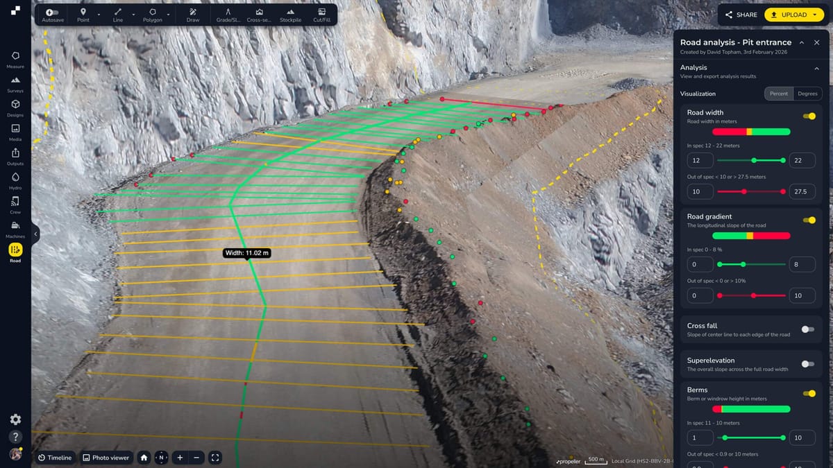
Propeller plans to embed Spacesium’s technology directly into its platform, starting with the release of Haul Road Analysis. This new tool calculates berm height, road grade, and width automatically, flagging any non-compliant areas for safety review. Propeller says these insights are instantly accessible to teams in the field. The company will continue developing AI tools alongside customers and will showcase them at Mining Indaba, MineXchange, and CIM Connect in the coming months.
🌀 Tom’s Take:
With this acquisition, Propeller is moving from capturing site data to using geospatial AI to automatically analyze it, starting with haul road safety in mining.
Source: Propeller