Niantic Advances Its Geospatial Platform for Real-World Mapping and Positioning

- Niantic Spatial introduced a set of updates to its platform for capturing, mapping, and positioning in real-world environments.
- The release expands spatial mapping beyond pre-scanned areas, adding new capture methods, global positioning, and broader development support across platforms into a single workflow.
Niantic Spatial is expanding its geospatial platform with a set of updates focused on capturing, mapping, and locating in the physical world. The release is part of its Large Geospatial Model, a system for creating and using spatial data with precise geometry and positioning. The company is focused on developing models that can operate in environments where traditional systems like GPS fall short.
Source: YouTube / Niantic Spatial
It all starts with Scaniverse, which Niantic says is its “self-serve platform for delivering spatial services.” The web and mobile platform supports data capture and upload, generates spatial assets such as meshes and splats, and enables localization using VPS. The update expands capture beyond mobile devices to include input from consumer phones and 360° cameras, with support for additional capture types and formats expected later this year. It enables mapping across spaces ranging from single rooms to large, complex sites, while allowing teams to contribute scans over time that are merged into a single model in the cloud. A single capture can generate multiple outputs, including meshes, splats, and positioning maps.
Niantic has also updated its visual positioning system. VPS 2.0 removes the need to map a location in advance and introduces global positioning, allowing it to work even in places without prior scans. In areas that are already mapped, it delivers near centimeter-level accuracy with full position and orientation. Elsewhere, it provides three degrees of freedom positioning and improves stability by correcting GPS errors and signal loss, particularly in indoor or dense urban environments where GPS is less reliable.
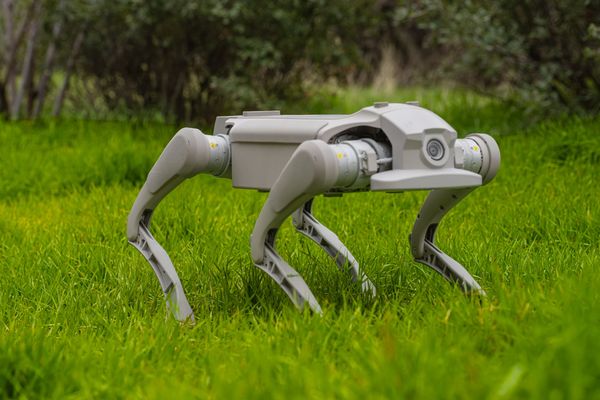
NSDK 4.0 is the upcoming update to Niantic Spatial’s development kit, focused on deploying applications built on Scaniverse and VPS. It adds expanded support for Swift, Unity, and native Android, along with early access to ROS 2, allowing developers to build across mobile and robotic systems using existing workflows. The update is designed to avoid locking teams into a single programming environment, supporting use cases across robotics, industrial sites, public sector operations, and large venues where reliable positioning and shared spatial models are required.
🌀 Tom’s Take:
Spatial maps become more useful when they can be continuously captured, updated, and localized across environments. Connecting these layers moves mapping closer to something machines can rely on in real-world conditions.
Source: Niantic Spatial
Disclosure: Tom Emrich has previously worked with or holds interests in companies mentioned. His commentary is based solely on public information and reflects his personal views.